
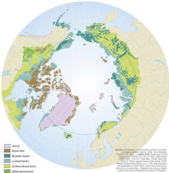
Vegetation zones in the Arctic
The Circumpolar Arctic Vegetation Map (CAVM) project is an international effort to map the vegetation and associated characteristics of the circumpolar region, using a common base map. The base map is a false colour infrared image created from Advanced Very High Resolution Radiometer (AVHRR) satellite data.
-
Produced by:Rekacewicz
-
Year:01/05/2005
Vegetation zones in the Arctic
Overview
What’s Inside
How to Use This Collection
Why It Matters:

Use Constraints
-
Region:
-
Activity:
-
Impact Area:
-
Competences:
-
Tags:
Photos included in album

Sorry, we couldn't find any posts. Please try a different search.