
- Collection
Sanitation and Wastewater Atlas of Africa – Circular Economy
Circular economy approaches to sanitation services in Africa focus mainly on wastewater management. Their goal is to not only enhance sanitation services’ delivery across…
- Collection
Sanitation and Wastewater Atlas of Africa – Human Health
Contaminated water and poor sanitation are linked to the transmission of many preventable diseases, the most common of which are diarrhoeal diseases. Diarrhoea is…
- Collection
Sanitation and Wastewater Atlas of Africa – Policy and Institutional Frameworks
The environmental, health and economic benefits of safe drinking water and sanitation in Africa are clear and well documented. Unpolluted ecosystems are better able…
- Collection
Sanitation and Wastewater Atlas of Africa – Ecosystems
Although Africa is home to 15 per cent of the world’s population, it only has 9 per cent of the global water resources (Wang…
- Collection
Sanitation and Wastewater Atlas of Africa – Wastewater Streams
Population growth, urbanization and economic activities have resulted in an increase in wastewater volumes across the world, with this trend expected to continue (Sato…
- Collection
Sanitation and Wastewater Atlas of Africa – Overview
Africa’s 29.65 million km2 of land area is home to over 1.3 billion people (Worldometers 2019), with this population expected to reach 1.7 billion…

- Video
Introducing: SeaBee
SeaBee is an exciting new initiative to use drones to map and monitor the Norwegian coastline, capturing better data, faster. To learn more, visit…

- Single Image File
Wood Warbler – Phylloscopus sibilatrix
The Wood Warbler (Phylloscopus sibilatrix) is a typical breeding bird of the beech forest. More information about the Raet National Park is accessible at…
- Photo Gallery
Hasseltangen Beech Forest, Raet National Park
The Hasseltangen beech forest in Grimstad, Norway is the north-westernmost protected beech forest in Europe.
- Video
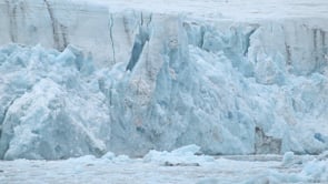
ECOTIP – Investigating tipping cascades in the Arctic seas
ECOTIP is a new European Horizon 2020 project led by the Technical University of Denmark and involving world class scientists from across Europe, Japan…

- Single Image File
Global distribution of permafrost: Dymaxion map
This Dymaxion map shows land and subsea permafrost. A Dymaxion or Fuller map is a projection of a world map onto the surface of…

- Single Image File
Многолетняя мерзлота в северном полушарии (Permafrost in the Northern Hemisphere: Russian)
This map shows terrestrial and submarine permafrost in the Northern Hemisphere. It was produced in 2020 as part of the Nunataryuk research project. The…