

- Single Image File
Arctic political map
The Arctic is extremely diverse in terms of landscapes, varying from pack and drift ice to rugged shores, flat coastal plains, rolling hills and…
- Single Image File
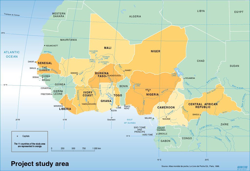
Poverty mapping study area
This map represents the study area for the poverty mapping project for West Africa for generation of reliable statistical and cartographic products to communicate…
- Collection
In Dead Water – Climate Change, Pollution, Over-harvest, and Invasive Species in the World’s Fishing Grounds
UNEP rapid response assessment on the state of the world's seas. In this report, the locations of the most productive fishing grounds in the…

- Single Image File
Coastal regions with observations of dense shelf water flushing
Knowledge and mapping of these processes is still scarce due to uneven research effort. The map shows sites with known dense shelf water cascading…

- Single Image File
Tropical sea temperature rises and coral reefs – Climate change scenarios
The impacts of coral reefs from rising sea temperatures. When coral reefs become heat-exposed they die, leaving the white dead coral, also known as…

- Single Image File
The state of the World’s fishery stocks

- Single Image File
Per cent of the global catch
Estimated per cent of the global catch taken at depths for the years 1950, 2000 and 2004, which illustrates how fishers are moving further…

- Single Image File
Atmospheric concentrations of carbon dioxide (CO2) – Mauna Loa or Keeling curve
Atmospheric concentration of CO2 is steadily rising, and oceans directly assimilate CO2. As ocean concentration of CO2 increases, the oceans automatically become more acidic.…

- Single Image File
Cumulative impacts on the marine environment
Climate change may, through effects on ocean currents, elevated sea temperatures, coral bleaching, shifts in marine life, ocean acidification and much more severely exacerbate…

- Single Image File
Ratio of wastewater treatment
Sewage treatment is low or absent in many parts of the World, leading to eutrophication of the coastal zone, (toxic) algae blooms and dramatically…

- Single Image File
Deep waters within and beyond areas of national jurisdiction in East Africa
The figure demonstrates that the overwhelming majority of marine areas under national jurisdiction in East Africa are deeper than 200 metres (dark blue). Areas…

- Single Image File
Climate change scenarios
Climate change models (B, C1–3) predict that the flow of dense shelf water (DSW) into the deep sea (A) will decrease in the next…