
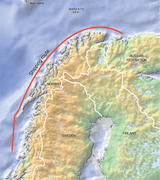
- Single Image File
Tanker routes along the Northern Norwegian Coast

- Single Image File
Nordområdena, from the North

- Single Image File
Barents Region, topography and bathymetry
The Barents Region is in the Arctic and covers the area of Western Russia and the northern areas of Finland, Sweden and Norway. The…

- Single Image File
Fisheries zones etc

- Single Image File
Projected changes in Arctic pack ice
The averages of the scenarios in the Arctic Climate Impact Assessment (ACIA) for the Arctic pack ice sheet (the permanent ice) are presented in…

- Single Image File
Norway, oil fields

- Single Image File
Barents Sea, oil fields and border delineations

- Single Image File
Open/closed areas for oil activities

- Single Image File
Fieldstatus
- Collection
Indigenous knowledge about disasters in the Russian north
Maps for a project on collecting local stories and surveys related to natural disasters among the Russian Arctic indigenous peoples (throught the RAIPON organization).

- Single Image File
Nenets Autonomous Okrug sites
Map, illustrating the communities, cities and sites from where the stories for the 'Indigenous Knowledge in Disaster Management' project has been collected and are…
- Collection
World Resources 2008: Roots of Resilience – Growing the Wealth of the Poor
The principles presented in the World Resources 2008 repor offers a way to screen development initiatives to ensure they best serve the poor by…